WELCOME TO THE RYF TRAVEL CLUB
Members are asked to register for this event in order for RYF to know who is planning to join us for the ride.
Members will be asked to indicate whether they will ride the shorter or longer route.
Riders will all be required to carry a route slip since this is an unfamiliar location.
NOTE: Route leaders are needed for the 39, 28 and 17 mile routes.
We encourage members to form car pools from Redlands to Irvine.
Please let the webmaster know if you have room available for a passenger and bike,
or if you need a ride. We will plan to have car pools meet at the IYBI Clinic at 6:30 am.
This ride will tour various locations of Southern Orange County, and include a ride through
the gardens of Turtle Rock, the scenic Shady Canyon, along San Diego Creek,
Corona Del Mar and Newport Beach, and along the Newport Back Bay.
Approximately 54% of this route will be on Class I bikeways.
Category E - Orientation Pace
Average speed 8 to 10 mph, with cruising speeds on flats between 10 to 15 mph. Ride length is typically 10 to 15 miles. This is usually an orientation ride, where riders are introduced to their bikes, riding in groups and rider safety. Light terrain, with the leader offering encouragement, advice and direction as needed. For families of all ages. Slow pace. Pace and stops vary.
Route Slip (pdf): Bayside - 17 RS
Google Earth map: Bayside - 17 GE
Category D - Social Pace
Average speed 10 to 12 mph, with cruising speeds on flats between 14 to 20 mph. Ride length is typically 25 to 35 miles. This is often a touring and/or social ride, with some stops to regroup at the discretion of the Route Leader.
Category C - Touring Pace
Average speed 12 to 14 mph, with cruising speeds on flats between 16 to 22 mph. Ride length is typically 35 to 45 miles. This is often a touring and/or scenic ride, with some stops to regroup at the discretion of the Route Leader.
Route Slip (pdf): Bayside - 39 RS
Google Earth map: Bayside - 39 GE
Google Earth map: Bayside - 51 GE
Travel Directions to get to the starting location:
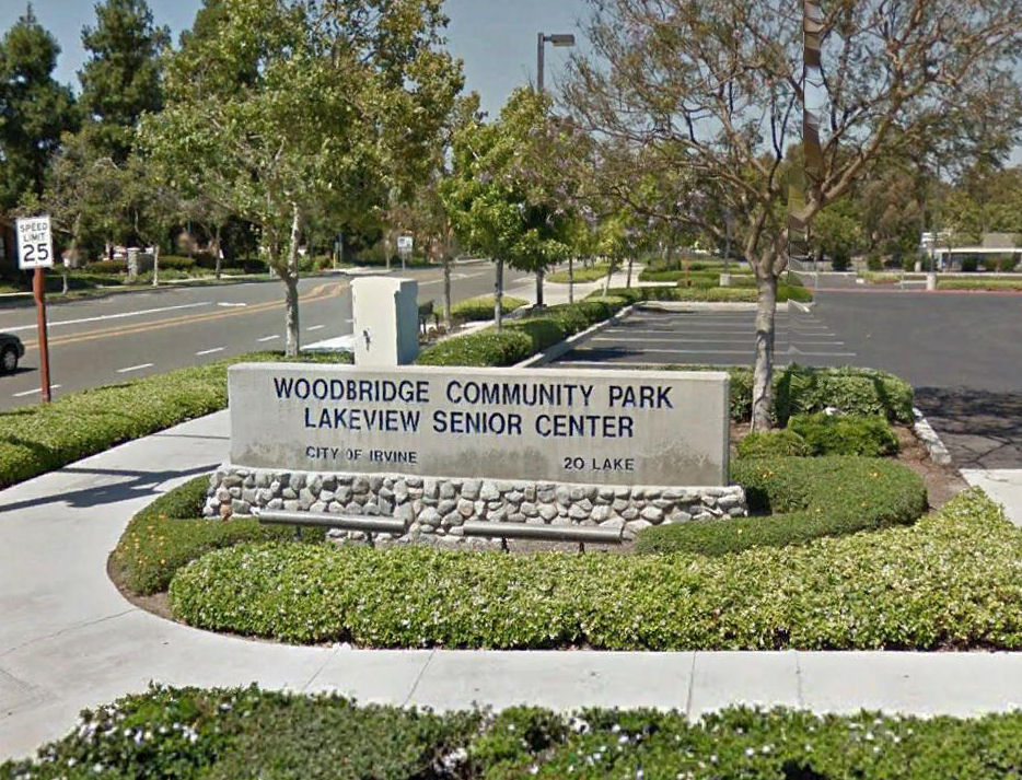
Woodbridge Community Part / Lakeview Senior Center, 20 Lake Road, Irvine
Using the SR 241 and SR 261 Toll Roads:
Take the 91 freeway through Corona. Exit onto the 241 toll road and proceed approximately 6.2 miles to the 261 toll road. Exit onto the 261 toll road and proceed approximately 8.45 miles to the end of the toll road at Jamboree Road and Barranca Parkway. Turn left at Barranca Parkway and proceed 1.8 miles to Lake Road. Turn right on Lake Road and proceed 0.25 miles to the entrance to Woodbridge Community Park. Turn left and proceed to the northeast parking lot along San Diego Creek, where RYF will meet. (Approx. 54 miles, toll road account required)
Alternate Route avoiding the toll roads:
Take the 91 freeway through Corona to the 55 freeway. Proceed south on the 55 freeway to the I-5 freeway. Take the I-5 freeway south and exit on Culver Drive, Exit 99. Turn right on Culver Drive and proceed 2.25 miles to Barranca Parkway. Turn left at Barranca Parkway and proceed 0.5 miles to Lake Road. Turn right on Lake Road and proceed 0.25 miles to the entrance to Woodbridge Community Park. Turn left and proceed to the northeast parking lot along San Diego Creek, where RYF will meet. (Approx. 60 miles.)
 |
 |
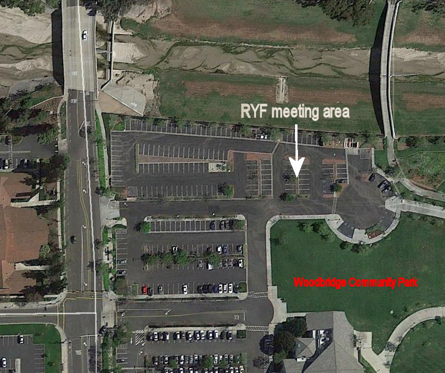 |
Woodbridge Community Park
|
Newport Back Bay Trail
|
Parking lot and meeting location
|
